Bogotá

Geography of Bogotá
Colombia, although notorious for its drug trafficking and armed conflict, is actually one of South America's most diverse, culturally rich and spectacular countries. Home to magical realism and one of the world's most beloved writers, Gabriel García Márquez, it is the land of lush jungles, colorful towns and scenic tropical beaches. Colombia is among the seven most bio-diverse countries on the planet and its emerald hills are the perfect terroir for some of the world's most exquisite coffee.
Boasting a growing economy, a peace process currently under way, and some of the warmest and most welcoming people in the world, it is no surprise the country has become the choice of an increasing number of expatriates.
Bogota is the most well-connected city in Colombia and a dynamic business center and the place where most opportunities are located. Occasionally London-like in appearance and weather, it may not be everybody's dream in a tropical country crossed by the Equator. Nevertheless, the plethora of opportunities available and its impressive cultural agenda can satisfy any preference and offers a taste of every region in the country.
Geography of Colombia
Located in the North of its continent, Colombia is the only country in South America with access to both the Atlantic and the Pacific Ocean. Its continental territory borders Panama, Ecuador, Peru, Brazil and Venezuela. Colombia lies between 17º N and 4º S latitudes, and has a total surface of 2,129,748 square kilometers, of which 1,141,748 is land, the remainder being maritime territories divided between the Caribbean Sea and the Pacific Ocean. Colombia is the fourth largest country on the continent, and the twenty-second in the world.
Colombian geography is usually divided into six natural regions, each with its own distinctive topographical, geological and biological traits: the Andean mountain range, the Pacific coastal region, the Amazon rainforest, the Eastern plains, the Caribbean coastal region and the Insular region.
The Andes, crossing the country from south to north, are its key geographical feature and the area where most of the population is concentrated. Although Colombia has access to the Amazon through the port of Leticia, it is not the country's most prominent river. The rivers Magdalena and Cauca, springing from the Colombian Massif and carving deep valleys along the Andes, are where Colombia's main cultures flourished both pre-Columbian and modern times. Additionally, the Amazon basin and the Eastern plains are also home to many of the biggest rivers in the country.
Situated on the Pacific Ring of Fire, Colombia has a higher risk of earthquakes and volcano eruptions than the rest of the world, especially along the Andean region.
The population of Colombia was of 49 million people in 2017, making the country the second most populous on the continent, after Brazil. The official language is Spanish, spoken by over 99% of the population, but a total of 65 indigenous languages, two creole languages and the Romani language are also spoken within its limits.
Colombia is divided into 32 departments and a Capital District.
Regions or Major Cities of Colombia
Major cities in Colombia include:
- Medellin – The second largest city of Colombia, with a population of almost three million, including suburbs, Medellin is the capital of the department of Antioquia, one of the most prosperous regions of the country. Its inhabitants call themselves "paisas".
- Cali – The biggest city in the south of the Country, but slightly smaller than Medellin, Cali is famous for being one of the world capitals of salsa. It is located in a fertile valley near the Cauca river, and its outskirts alone produce almost 4% of the sugarcane consumed worldwide.
- Barranquilla – The most important economic center on the Caribbean coast, it has a population of nearly two million. Historically insignificant, Barranquilla has risen to its current prosperity level thanks to the wealthy Middle Eastern immigrants who arrived during the first half of the 20th century. Their business sense, coupled with the city's strategic location on the Magdalena river mouth, made Barranquilla one of the most important trade centers in the region.
- Cartagena – One of the oldest and most beautiful cities in South America, Cartagena was for a long time Colombia's main port on the Caribbean and a serious cultural and political competitor for Bogota. During colonial times it served as a point of entry for the transatlantic slave trade, reason for which a significant share of the city's current population has African origins. Its well-preserved historical center has been called "the Pearl of the Caribbean".
Climate of Colombia
The climate in Colombia is tropical, with steady temperatures throughout the year and dry seasons alternating with rainy ones. However, the features of each of the six geographical regions combine in unique ways, making the country extremely diverse, with an array of climates spanning from dessert to humid rainforest and glacial areas.
More than across latitude, the climate varies with the altitude. While lowlands and territories below 1000 meters above sea level have warm and generally humid climates with temperatures above 24ºC, areas between 1001 and 2000 meters have average temperatures from 17º to 24ºC, areas from 2001 meters to 3000 have a cold climate with average temperatures between 12º-17ºC and regions above 3001 meters are alpine or glacial.
Time Zone in Colombia
Colombian time zone is UTC-5:00.
As most of the country is very close to the equator and daytime and nighttime vary little across the year, no daylight saving time exists. Sunrise occurs at roughly 6:00 a.m., and sunset at around 6:00 p.m. during the entire year, with variations of less than one hour from one solstice to the next.
Geography of Bogota
Bogota is located in the center of the country, at a latitude of 4ºN, and it is administratively organized as an independent district located within the department of Cundinamarca. Its urban area spreads over 307 square kilometers, in the vast and flat plateau in the Eastern Andean mountain range known as the "Bogota savanna".
Standing at an average altitude of 2640 meters (8660 ft) above sea level, it is one of the highest capitals in the world.
Bogota is the most populous urban agglomeration in Colombia, with almost 9 million people living within the metropolitan area.
Cityscape of Bogota
The Bogota cityscape is marked by the Eastern Hills (cerros orientales), running from South to North and bordering the city to the East. The Bogota River, which sets the Western limit, is less visible but equally significant. Limited by the mountains and the river to the East and West, the city has expanded primarily towards North and South.
The mountains of Montserrate and Guadalupe, part of the Eastern Hills, overlook the historical center and also have a cultural value as historic sites and pilgrimage destinations.
The city is organized roughly as a grid, with streets divided into Calles (running from East toWest), Carreras (North to South), and the lesser used Diagonales (deviations from a Calle) and Transversales (deviations from a Carrera).
Addresses in Bogota
Addresses in Bogota may be confusing for first-time visitors, as most streets don't have names, but numbers. Calles are numbered from 1 upwards, with Calle 1 in the historical center and the consecutive streets northwards. However, there is a parallel numbering from callesSouth of Calle 1, with "Sur" added to the name (e.g. Calle 1 Sur) In the case of Carreras, the first Carrera runs along the Eastern mountain range, and all streets West of it are numbered consecutively (e.g. Carrera 2, Carrera 3).
An address starts with the name of the Calle or Carrera, followed by the number of the nearest perpendicular street and a number of the building within the block. For example, "Calle 3 #5-23" is on Calle 3, at the height of Carrera 5, at number 23.
Climate of Bogota
Due to its altitude, Bogota has a cold mountain climate, with temperatures ranging between 7º-18ºC and an annual average of 14ºC.
Rains can occur anytime during the year, but most precipitations are concentrated during the rainy seasons, which run from March to early June and from September to November. January and February are the driest months of the year, with occasional freezes during night time. August is popularly known to be the windiest month of the year.
For up-to-date weather information, consult Bogota Weather.
Districts of Bogota
Bogota is divided into 20 districts (localidades), each one consisting of various neighborhoods. Some of the most important districts are:
- Santa Fé – This is the center of the city, where many institutions, businesses and landmarks are located. It was named after the first name of Bogota at its foundation.
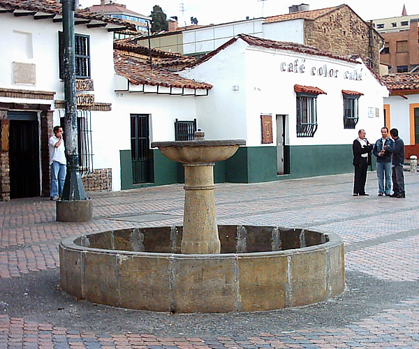
- La Candelaria – The most recently created district, in the oldest area of Bogota, La Candelaria comprises the historical center of the city. Most of the tourist attractions are located there, including Chorro de Quevedo square and the first church built in Bogota.
- Chapinero – A mostly middle and high-income district North of Santa Fé, it concentrates the city's business and nightlife hotspots, while also being one of the traditional areas of Bogota. Carrera 7, one of the city's main avenues, passes through Chapinero.
- Usaquén – Located in the North of the city, it is a high-income area that borders the Eastern Hills. Many commercial centers, businesses and residential areas are found in Usaquén.
- Teusaquillo – Possibly the greenest area of Bogota, as most parks are concentrated there, Teusaquillo's name comes from the name of a pre-Columbian indigenous leader. It is a middle-class district home to many universities and cultural institutions. Some of Bogota's most typical neighborhoods are located there.
Update 20/08/2018
Keep more of your money when transferring funds overseas!
If you want to move money abroad, from Colombia or to Colombia for example, Fexco provides efficient and secure global bank to bank transfers and bespoke payment solutions for both business and personal clients.
Why Fexco
Fexco provides a secure international money transfer service online or by telephone with bank beating fx rates and low fees. Specialises in high-value transfers.
Faster, cheaper, safer International money transfers.
Dedicated fx dealer who will oversee your transfer from start to finish
Make payments from anywhere with our secure online platform, PayDirect.
If you prefer the personal touch, then our payments team can be contacted by phone.
Main characteristics
Fexco will help you to keep your overseas money transfer costs to a minimum.
| Margin | 0.6% |
|---|---|
| Regulator | FCA |
| Fee | £10 < £5K or Free > £5k |
| Mini | £1K |
| Ccy | All (130 currencies, incl ‘exotics’) |
| Services | Repatriation of funds, Property, Regular payments, High Value payments, spot, online, telephone. |
Get an online quote today
When you are ready to make your transfer, John and his team will be available to help you with better rates and an unrivalled service to make sure your funds are delivered securely and speedily.
Do you have comments or personal information to communicate about this article? Add your comment.
Find links about overview / geography of Bogotá and a lot more in The links of expatriation.
Find more definitions and general answers on expatriation issues in the Expat FAQ (Frequently Asked Questions).
Go to the Forum to talk more about geography of Bogotá, overview.